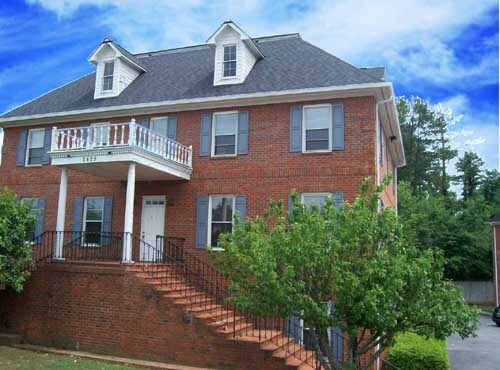
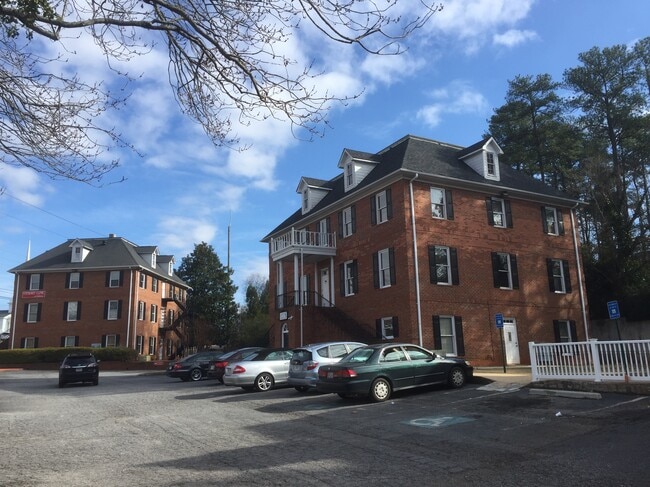
Property Record
115 Sycamore Dr, Athens, GA 30606
NEARBY LISTINGS FOR SALE OR LEASE
Property Detail
115 Sycamore Dr
Athens-Clarke County, GA
Com-Bv-065
121D4-D-003
SUBD BLK: B3,LOT: U115;
Officebuilding
Clarke
X
Georgia
13059C0024F
u115
2025
0.30 AC
2025
Beechwood
001200
Other Market Areas
6,837 SF
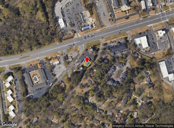
DEMOGRAPHICS near 115 Sycamore Dr
1 Mile
3 Mile
5 Mile
2024 Total Population
8,580
64,883
114,158
2029 Population
8,556
65,352
115,896
Pop Growth 2024-2029
(0.28%)
+ 0.72%
+ 1.52%
Average Age
38
34
34
2024 Total Households
4,051
25,001
45,028
HH Growth 2024-2029
(0.30%)
+ 0.73%
+ 1.39%
Median Household Inc
$49,028
$51,216
$52,039
Avg Household Size
2.00
2.10
2.30
2024 Avg HH Vehicles
1.00
2.00
2.00
Median Home Value
$297,175
$311,593
$281,870
Median Year Built
1979
1982
1987
Nearby Places
Map Layers
Map Styles
 Street
 Aerial
- Restaurants
- Banks
- Shops
- Fitness
- Groceries
SALE & LEASE HISTORY
LISTING DATE
SALE/LEASE

May 03, 2020
For Sale
Mar 29, 2020
For Lease
Dec 01, 2016
For Lease
Nearby Properties
Address
Land Use
TOTAL SIZE
Lot Size
Zoning
Address
Land Use
TOTAL SIZE
Lot Size
Zoning
11.36 AC
G
Address
Land Use
TOTAL SIZE
Lot Size
Zoning
33.61 AC
G
Address
Land Use
TOTAL SIZE
Lot Size
Zoning
81,812 SF
6.23 AC
C-D (RIV)
Address
Land Use
TOTAL SIZE
Lot Size
Zoning
21.57 AC
G
Address
Land Use
TOTAL SIZE
Lot Size
Zoning
49.33 AC
G
Address
Land Use
TOTAL SIZE
Lot Size
Zoning
35 AC
G
Address
Land Use
TOTAL SIZE
Lot Size
Zoning
17.90 AC
G
Address
Land Use
TOTAL SIZE
Lot Size
Zoning
24.70 AC
G
Address
Land Use
TOTAL SIZE
Lot Size
Zoning
47.56 AC
G
Address
Land Use
TOTAL SIZE
Lot Size
Zoning
163,904 SF
3.75 AC
C-D
Address
Land Use
TOTAL SIZE
Lot Size
Zoning
10,240 SF
6.47 AC
G
Address
Land Use
TOTAL SIZE
Lot Size
Zoning
16.60 AC
G
Address
Land Use
TOTAL SIZE
Lot Size
Zoning
21.64 AC
G
Address
Land Use
TOTAL SIZE
Lot Size
Zoning
122,400 SF
12.51 AC
G
Address
Land Use
TOTAL SIZE
Lot Size
Zoning
85,608 SF
63.75 AC
RM-2
Address
Land Use
TOTAL SIZE
Lot Size
Zoning
21.04 AC
G
Address
Land Use
TOTAL SIZE
Lot Size
Zoning
8.38 AC
G
Address
Land Use
TOTAL SIZE
Lot Size
Zoning
87,066 SF
36.66 AC
RM-2
Address
Land Use
TOTAL SIZE
Lot Size
Zoning
213,612 SF
3.07 AC
C-D
Address
Land Use
TOTAL SIZE
Lot Size
Zoning
212,919 SF
37.92 AC
RM-1
Address
Land Use
TOTAL SIZE
Lot Size
Zoning
81,792 SF
30.99 AC
RM-1
Address
Land Use
TOTAL SIZE
Lot Size
Zoning
184,293 SF
1.84 AC
C-D
Address
Land Use
TOTAL SIZE
Lot Size
Zoning
56.15 AC
G
Address
Land Use
TOTAL SIZE
Lot Size
Zoning
226,339 SF
2.32 AC
C-D (RIV)
Address
Land Use
TOTAL SIZE
Lot Size
Zoning
36.88 AC
G
Address
Land Use
TOTAL SIZE
Lot Size
Zoning
20 AC
G
Address
Land Use
TOTAL SIZE
Lot Size
Zoning
17.23 AC
G
Address
Land Use
TOTAL SIZE
Lot Size
Zoning
6.15 AC
G
Address
Land Use
TOTAL SIZE
Lot Size
Zoning
97,317 SF
24.31 AC
C-G
Address
Land Use
TOTAL SIZE
Lot Size
Zoning
81,973 SF
4.97 AC
G
The World's #1 Commercial Real Estate Marketplace
Connect with us
© 2025 CoStar Group
The information above has been obtained from sources believed reliable. While we do not doubt its accuracy we have not verified it and make no guarantee, warranty or representation about it. It is your responsibility to independently confirm its accuracy and completeness. Any projections, opinions, assumptions, or estimates used are for example only and do not represent the current or future performance of the property. The value of this transaction to you depends on tax and other factors which should be evaluated by your tax, financial, and legal advisors. You and your advisors should conduct a careful, independent investigation of the property to determine to your satisfaction the suitability of the property for your needs.